WOW or Wolverine's Out West
It's not too late to come and join us as we return to two of the best locations in the United States for four-wheeling! You can choose either or both: Ouray Colorado (September 28-30) or Moab Utah (October 2-6) Come for the entire time, just a week or any day you can. We will be tackling some of the most scenic and challenging trails in the west. There is NO COST to join in the fun (other than your own lodging and food). We will be updating this page as we get closer to the trip and hope to have you join us!
We will be sending out additional information to registered attendees on a regular basis and a copy will be posted on the members only portal. Most of our WOW attendees are using VRBOs, Airbnb or camping in the area. Let us know if you need help in finding accommodations. While there may be a bit of snow at the higher elevations, we should be good on most if not all the passes.
We will be ordering T-Shorts shortly. We do not have a cost yet for the shirts but Mark D. will have a cost soon. Let Nancy know and she will update the spreadsheet to aid in the ordering process. We need your size and how many you want.
Ouray Colorado
Tuesday September 27th- Trail Leader Budnick
Meet at Yankee Girl Restaurant in town they open at 7:30am. Departure time is 9:30am from there.
Looking like Yankee Boy Basin (4.75 miles) with a quick in/out to Govenor Basin (2.8 miles) and if time permits Siver Basin. Plan is to return to Ouray for lunch. After lunch the group will head back out to explore Spirit Gulch a 6.2 mile loop with an option for US Basin Road.
Thursday September 28th - Trail Leader Budnick
Meet at Yankee Girl Restaurant in town they open at 7:30am. Departure time is 8:30am from there.
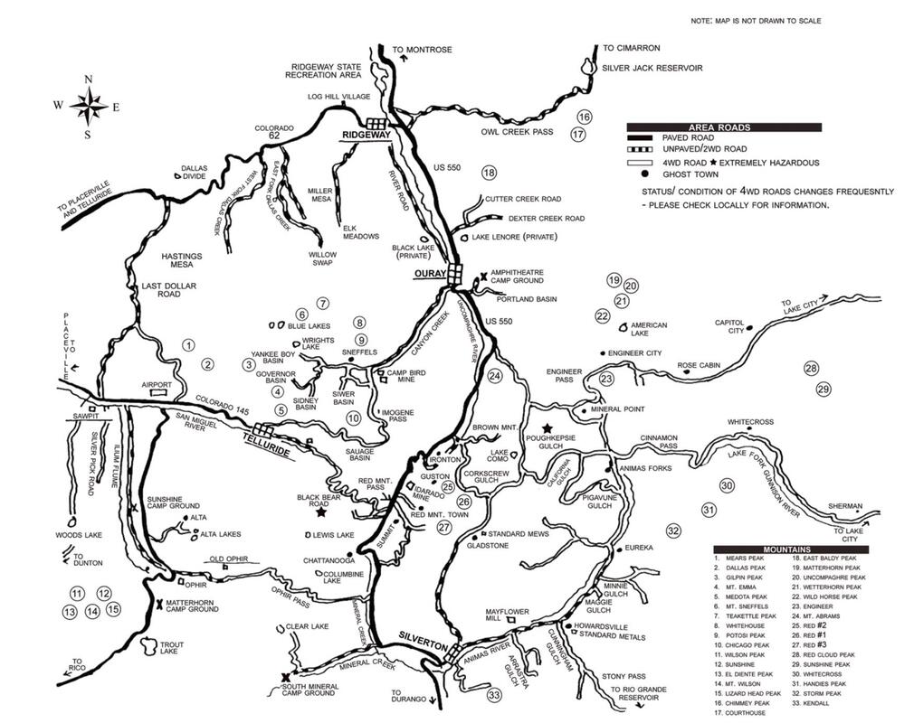
Corkscrew Gulch Trail
Corkscrew Gulch Trail (Moderate) ½ hour 4.8 miles
STARTING POINT: Intersection of US 550 and FR 886
FINISHING POINT: Intersection with Southwest #14: Silverton to Lake Como Trail
TOTAL MILEAGE: 4.8 miles
UNPAVED MILEAGE: 4.8 miles
DRIVING TIME: 1/2 hour
ROUTE ELEVATION: 9,800 to 12,600 feet
DIFFICULTY RATING: 4
SCENIC RATING: 9
This route is moderately difficult to drive because some sections of the road are rough, steep, and narrow, and there are several sharp switchbacks to negotiate. Other than locating the start of the trail, which is unmarked, driving the trail is easy to follow.
The route begins at the Idarado Mine tailing pond on US 550. Initially the road, which is unmarked but designated as FR 886, travels through the forest as it starts the ascent into Corkscrew Gulch. After you cross a couple of shallow creeks, you encounter several switchbacks as the road climbs out of the gulch. Once above timberline, you have a panoramic view of adjoining mountains and valleys, including the three Red Mountains. As the road starts to descend, you re-enter the forest. From the turnoff to Gray Copper Gulch, the road is quite steep immediately prior to coming to an end at the intersection with Southwest #14.
California Gulch Trail
California Gulch Trail (Moderate) 1 hour 4.2 miles
STARTING POINT: Animas Forks
FINISHING POINT: Intersection with Southwest #14: Silverton to Lake Como Trail
TOTAL MILEAGE: 4.2 miles
UNPAVED MILEAGE: 4.2 miles
DRIVING TIME: 1 hour
ROUTE ELEVATION: 11,400 to 12,930 feet
DIFFICULTY RATING: 4
SCENIC RATING: 9
This route departs to the northwest of Animas Forks and is clearly marked to California Gulch. Traveling along California Gulch is a relatively easy road, entirely above timberline, with numerous mine remains and open mine portals in evidence. The road ascends to California Pass, which provides a spectacular 1800 view. It looks down onto Lake Como and Poughkeepsie Gulch, back to the road to Animas Forks, and across to Hurricane Pass and Hurricane Peak. The section of the road descending from California Pass is the harder part of this route and traverses quite different terrain. There is a series of tight switchbacks along a narrow shelf road. At times, the road is steep, and passing other vehicles can be difficult.
Cinnamon Pass Trail
Cinnamon Pass to Animas Forks Trail (Moderate) 2 hours 26.8 miles
STARTING POINT: Lake City at intersection with Southwest #1: Engineer Pass Trail
FINISHING POINT: Animas Forks
TOTAL MILEAGE: 26.8 miles
UNPAVED MILEAGE: 20.4 miles
DRIVING TIME: 2 hours
ROUTE ELEVATION: 8,932 to 12,620 feet
DIFFICULTY RATING: 3
SCENIC RATING: 9
Today Cinnamon Pass Trail is a seasonal, moderately easy 4WD road. It is part of the historic and majestic Alpine Loop. The other half of the loop is Engineer Pass 4WD Trail. These two roads form the backbone of a network of roads throughout the region. Cinnamon Pass Trail is the easier of the two, but in the peak summer months both are extremely popular 4WD routes. The scenery varies from the rugged alpine environment of year-round snow and barren talus slopes near the summit to the wildflower-covered valleys and rushing streams draining the melting snow. At either end of the route are wonderful, historic towns, one a ghost town, the other very much alive.
Initially, the gravel road is an easy, maintained road. After entering the Gunnison National Forest, the road is intersected by the road to Wager Gulch on the left. This road (Southwest #4) goes to the ghost town of Carson and continues over the Continental Divide.
Three miles further along County 30 is the intersection with County 35—a short side road leading to the site of Sherman. While the remains of the town are clearly visible, the forest has reclaimed the entire area. After the Sherman turnoff, the road narrows into a shelf road overlooking the canyon. However, it remains comfortably wide even for full-sized 4WD vehicles, with a sufficient number of pull-offs available to facilitate passing.
A short distance further, the road enters Burrows Park Basin—the region of Whitecross, Burrows Park, Tellurium, and Sterling townships. The road passes the two remaining buildings of Burrows Park (and a new public toilet).
About three and one-half miles further, after passing the turnoff to the American Basin, which is renowned for its spring wildflowers, the road becomes more difficult as it ascends above timberline into alpine tundra vegetation and offers expansive views. From the summit of Cinnamon Pass, the road descends into the picturesque ghost town of Animas Forks, which has numerous buildings remaining.
Engineer Pass Trail
Lake City to Engineer Pass (Moderate) 3 hours 27.2 miles
STARTING POINT: Lake City—Cinnamon Pass Trail
FINISHING POINT: Ouray
TOTAL MILEAGE: 31.0 miles
UNPAVED MILEAGE: 27.2 miles
DRIVING TIME: 3 hours
ROUTE ELEVATION: 8,932 to 12,750 feet
DIFFICULTY RATING: 4
SCENIC RATING: 10
This route commences south from Ouray on the Million Dollar Highway, US 550.
If you wish to avoid the hardest section of the Engineer Pass Trail, the route can be commenced at Silverton by taking the road to Animas Forks (Southwest #6) and then the North Fork Cutoff (Southwest #5) to connect with Engineer Pass Trail. The turnoff from US 550 onto Engineer Pass Trail is well marked with a national forest access sign. This 4WD track gets straight down to business. In fact, the next five miles are the hardest of the entire trip. Sections of the road are steep and rough. It is also narrow with sheer drop-offs. Although it may appear threatening at first, it is readily passable for 4WD vehicles if taken slowly and carefully. A tip for those who are nervous about driving shelf roads and encountering oncoming vehicles: Leave early. This road is popular, and oncoming 4WD vehicles will be encountered frequently later in the day, as those traveling from Lake City are descending. Pull-offs are reasonably frequent.
At the 1.6-mile point, you pass the Mickey Breene Mine, which was discovered in 1890. The mine yielded high-grade ore and produced copper and silver. About two and one-half miles from US 550, the road intersects with the Poughkeepsie 4WD road. From the Mineral Point turnoff, the terrain starts to clear, with numerous open, although boggy meadows. The climb continues to Engineer Pass at 12,750 feet.
From the summit, the road descends through the southern edge of American Flats and past the site of Engineer City. From this point, the road follows the path of Henson Creek all the way to Lake City. About two miles after the summit, there is a scenic old cabin beside the creek at Palmetto Gulch; shortly after that, a bridge crosses the creek at what was the site of the Palmetto Gulch Mill. From this point, the road is passable by passenger vehicles.
The road passes close by Rose’s Cabin, which was an important way station on the stage route. The remains of the buildings can still be seen. Less than a mile further is the Empire Chief Mill that was worked from January to March 1929, when an avalanche killed four men and destroyed most of the buildings. A few miles on, a sign marks a short walking trail down to beautiful Whitmore Falls. Though short, the hike back up is strenuous. The original Capitol City, with its grand aspirations to be the state capital, is now reduced to the remains of the post office. However, the town site is on private land, and new homes continue to be built there.
The route continues to Henson and then through Henson Creek Canyon to Lake City
Bulldozers plow portions of Engineer Pass, which is usually opened around mid-June. When the road crews get through, they leave in their wake a narrow channel through the snow, with walls of snow up to twenty feet high on either side.
Nellie Creek Trail
Nellie Creek Trail / possible side trip depending on time (Moderate) ¾ hour 4 miles
STARTING POINT: Intersection of Southwest #1: Engineer Pass Trail and FR 877
FINISHING POINT: Uncompahgre Peak Trailhead
TOTAL MILEAGE: 4 miles (one-way)
UNPAVED MILEAGE: 4 miles
DRIVING TIME: 3/4 hour
ROUTE ELEVATION: 9,400 to 11,500 feet
DIFFICULTY RATING: 4
SCENIC RATING: 8
The initial section of this road is a gentle climb through the forest following the course of Nellie Creek. This lower section of the creek and the nearby forest show the signs of many industrious beavers’ labor. The trail is rough with occasional loose boulders, but generally they are embedded and it is not difficult to drive in a high-clearance vehicle. The biggest problem you are likely to have is passing vehicles you encounter traveling the other way, as some sections are too narrow to pass without one driver reversing to a suitable spot.
There are numerous aspen trees at the lower reaches that add color in the fall to the already very attractive scenery provided by the Nellie Creek, which flows beside the trail for much of the route, and a waterfall located at the 0.7-mile point. After about three-quarters of a mile, there is a section of shelf road upon which you continue the climb. The road levels off after a little more than a mile and a half and you get a good view of Uncompahgre Peak. After you cross a shallow creek, the climb through the forest continues. The trail switchbacks up to another relatively level segment that can become quite boggy in wet weather conditions. The trail becomes rougher at this time and there are a number of shallow creek crossings. This section is the most difficult part of the trail but under dry conditions it only just warrants a rating of 4. After about three miles, the trail levels off and enters an alpine meadow. A mile further, the trail ends at the parking area for the Uncompahgre Peak Trailhead.
Friday September 29th - Trail Leader Green
Poughkeepsie Gulch
Meetup at Ouray Hot Springs-Pool on Main Street Highway 550 time 8:00AM Mountain Time
STARTING POINT:
FINISHING POINT:
TOTAL MILEAGE: 5.2 miles
UNPAVED MILEAGE: 5.2 miles
DRIVING TIME: 3 hours
ROUTE ELEVATION: 10,143 to 12,535 feet
DIFFICULTY EATING: 5-7
SCENIC RATING: 8
Poughkeepsie Gulch is about the only challenging Jeep trail in the San Juans. There is one major obstacle called "The Wall" that causes the 7-rating. When most people talk about this trail they focus on "The Wall". That is important, but the scenery in the gulch is also worthy of mention - especially Lake Como. Until 2015 there was no bypass for the wall. You had to climb it or go back. This caused quite a few accidents so a bypass was built and you can now enjoy Poughkeepsie Gulch without the major challenge. The trail in is rated at a strong 5. There is at least one tricky ledge and quite a stretch of road with many boulders. The bypass, and the road beyond, is easier. This is a secluded trail with some amazing obstacles to play on. Try your luck on the main obstacle which is a very steep rock with an occasional audience. You can winch if you need to, or bypass it if you can't make it up and over.
Picayne Gulch and Placer Gulch Trail
Picayune and Placer Gulches (Moderate) 1 hour total 6.2 miles
STARTING POINT: Intersection with California Gulch Trail
FINISHING POINT: Intersection with Silverton to Animas Forks Ghost Town road
TOTAL MILEAGE: 6.2 miles
UNPAVED MILEAGE: 6.2 miles
DRIVING TIME: 1 hour
ROUTE ELEVATION: 10,500 to 13,000 feet
DIFFICULTY EATING: 4
SCENIC RATING: 8
From the start of this route, the road immediately crosses the West Fork of the Animas River. The road continues into the gulch and travels above Placer Creek. The scenery in the gulch is treeless alpine tundra. The beauty of the open countryside is enhanced in the early summer by massive displays of wildflowers. Placer Gulch still holds much evidence of the mines, mills, and tramways that turned it into a hive of activity long ago.
The road to the Gold Prince Mine at the top of the gulch is the easier part of the trail and would only rate a 3 for difficulty. From the Gold Prince, the road switchbacks up to the ridge and crosses into Picayne Gulch. This segment is fairly steep but is quite wide; there are plenty of opportunities to pass oncoming vehicles. Once into Picayne Gulch you travel through broad, open meadows where flocks of sheep are left to graze in the summer. This section of road is cleared by snowplow at the start of the season and can be quite muddy when wet.
The road re-enters the forest and passes the cluster of buildings constructed by the Treasure Mountain Gold Mining Company. These include a substantial boardinghouse that had an adjoining bathroom with bath, toilet, and hot and cold running water. The bathroom was connected to the boarding house by an enclosed corridor.
The last section of the route is a narrow shelf road that descends to intersect with the Silverton to Animas Forks road. Passing opportunities are limited on this short section, but the surface is sound and it is not very difficult.
Minnie Gulch Trail
Minnie Gulch Trail (Moderate) 2 hours round trip 3.9 miles each way
STARTING POINT: Intersection with Southwest #6: Silverton to Animas Forks Ghost Town road and FR 587
FINISHING POINT: Kittimac Mine
TOTAL MILEAGE: 3.9 miles (one-way)
UNPAVED MILEAGE: 3.9 miles
DRIVING TIME: 1 hour
ROUTE ELEVATION: 9,800 to 11,800 feet
DIFFICULTY RATING: 4
SCENIC RATING: 8
This route heads east from Southwest #6: Silverton to Animas Forks Ghost Town road, initially traveling through the forest beside Minnie Creek. A little over a mile from the start is the site of the Caledonia Mill on the left, across Minnie Creek. Continuing along the route you come to a fork in the road; both legs of this fork are included in this route. The left-hand fork is explored first. This road switchbacks up the mountain and although it is narrow, the surface is sound. You pass a tram support for the Kittimac Mine tram that transported to the Kittimac Mill located on the Animas River, just south of the start of this 4WD trail.
Farther along is the Caledonia Mine boardinghouse and stables. The boardinghouse is leaning at a precarious angle, only saved from collapse by the supports that have been put in place. The road continues to the Caledonia and Kittimac mines. As it does, it gets narrower and steeper. Turn at an appropriate place and head back down to the fork in the road to explore the other leg, which leads to the Esmerelda Mine.
Once on the right-hand fork, the road heads farther up Minnie Gulch traveling above the creek. It passes two cabins, a waterfall from a side creek, and another cabin with a stone foundation—all on the left side of the road. The road gets more difficult as you travel along this last section, so turn whenever you think conditions warrant and return to the beginning of the trail. The difficulty rating for this trail reflect conditions at the upper reaches of both forks. The earlier stages are quite easy. The vane scenery and the numerous mining remains make this short trail well worth doing.
Maggie Gulch Trail
Maggie Gulch Trail (Easy if time permits) 2 hours round trip 4.1 miles each way
STARTING POINT: Intersection of Southwest #6:Silverton to Animas Forks Ghost Town road and FR 588 at the town site of Middleton
FINISHING POINT: Intersection Mill
TOTAL MILEAGE: 4.1 miles (one-way)
UNPAVED MILEAGE: 4.1 miles
DRIVING TIME: 1 hour
ROUTE ELEVATION: 9,800 to 11,900 feet
DIFFICULTY RATING: 3
SCENIC RATING: 8
This trail starts at the town site of Middleton. Nothing remains today but a public toilet is located at the site. The road forks almost immediately and you bear left up a straightforward shelf road, switch backing up the mountain. The right-hand fork is a short road that leads to several backcountry camping spots.
As the road climbs, it affords a good view along the gulch. You travel along a fairly wide shelf that is lined with pine and aspen. At this stage, the route is easy with a smooth, sound surface and adequate places to pass any oncoming vehicles. After less than a mile, you have climbed almost 1,000 feet and the scenery changes dramatically as you emerge above the timberline to cross an expansive talus slope. The aspen in the gulch below provide a particularly scenic view in the fall. The Ridgeway Mine tram is also evident in the valley.
The route then crosses a short, narrow section of shelf road as you pass a scenic waterfall at the top of the gulch. The scenery changes again as you enter a broad alpine basin and proceed along the last stage of the journey ending at the Intersection Mill. There are extensive ruins of the mill and its machinery, which operated in the early l900s. At this point, the road contracts to a hiking trail, which continues to the Continental Divide, crossing it about three-quarters of a mile northeast of Stony Pass.
Saturday September 30th - Trail Leader Dabkowski
Meetup at 38.01792, -107.67521 at 9:00AM Mountain Time
Imogene Pass Trail
Imogene Pass to Ouray Trail #3 (Moderate) 2-1/2 to 3 hours 12.8 miles
STARTING POINT: Intersection with Southwest #18: Yankee Boy Basin Trail
FINISHING POINT: Telluride
TOTAL MILEAGE: 12.8 miles
UNPAVED MILEAGE: 12.2 miles
DRIVING TIME: 2 ½ hours
ROUTE ELEVATION: 9,000 to 13,114 feet
DIFFICULTY RATING: 4
SCENIC RATING: 9
Imogene Pass is the second highest pass road in the United States and provides a wonderfully scenic route through the San Juan Mountains. The route passes two major mining camps: Camp Bird and Tomboy. From the Yankee Boy Basin turnoff, the road deteriorates and becomes 4WD. The track passes through the forest and Imogene Creek Valley. There are a number of creek crossings as the track proceeds toward the pass, although none should prove to be any problem for a 4WD.
The road narrows for the final ascent to the pass, but there are adequate pull-offs available for passing. About two miles from the pass, the track enters the ghost town of Tomboy, 2,880 feet above Telluride, three miles distant, with its numerous historic remains. Although the buildings of Tomboy continue to deteriorate from the onslaught of harsh weather, Tomboy remains one of the better ghost towns to explore; many of the foundations and some of the structures are clearly evident. Some two miles past Tomboy, the road passes through Social Tunnel, a short passage through a rock outcrop that provides a popular photo opportunity. This point also provides spectacular views of the switchbacks on Black Bear Pass Trail and both Ingram Falls and Bridal Veil Falls.
Telluride - Lunch and a bit of shopping!
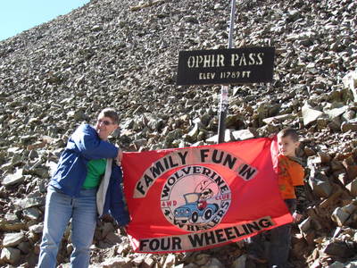
Ophir Pass Trail
Ophir Pass to Telluride Trail #5 (Moderate) 2 plus hours 9.8 miles
STARTING POINT: Intersection of Colorado 145 and FR 630 south of Telluride
FINISHING POINT: Intersection of FR 679 and US 550 between Ouray and Silverton
TOTAL MILEAGE: 9.8 miles
UNPAVED MILEAGE: 9.8 miles
DRIVING TIME: 1 3/4 hours
ROUTE ELEVATION: 9,500 to 11,789 feet
DIFFICULTY RATING: 3
SCENIC RATING: 9
The turnoff from Colorado 145 at the site of the Ophir Loop starts this track; but it is not well marked, so we recommend that you measure the distance from Telluride on your odometer. Those with GPS receivers will be glad to have the benefit of modern technology. (GPS: N37 51.74’ W 107 52.11’)Across the highway from the start of this trail is a short road to the township of Ames, the site of the first commercial, alternating-current electricity generating plant in the United States.
As you leave the old township of Ophir, the road starts to ascend immediately through scenic woods and aspen stands. As the ascent continues, the road rises above the timberline and becomes a narrow shelf road cut into the talus slope with some tight switchbacks and high, steep drop-offs. This section is the most difficult part of the route. For a short section, passing requires careful negotiation. Traveling slowly and carefully, moderately experienced drivers should not have any difficulty. The road is certainly easier than the Black Bear Pass Trail, but those who are tempted to take the route too lightly should heed the lesson offered by the remains of a wrecked vehicle that rolled off the road at this point.
From the summit of the pass to US 550, the route is much easier. Although the road is wider and the footing more sound, it remains a shelf road for much of the balance of the journey. The varied scenery offers some particularly panoramic views on the west side. The east side is more heavily wooded than the west side, and the wildflowers in the valley add color. The intersection with FR 820 offers an alternative route to US 550. The road, about 1.5 miles long, at times provides a challenging crossing through Mineral Creek. It joins US 550 0.7 miles north of where the main route intersects. Ouray is about eighteen miles north and Silverton five miles south of the intersection with US 550.
Sunday October 1st
Travel Day from Ouray to Moab
Moab Utah
Beginning Jan. 1, 2023, Utah will require all OHV operators to complete the free Utah Off-Highway Vehicle Education Course. Operators under the age of 18 shall possess a youth OHV education certificate in order to operate an OHV on public land, road or trail. Operators 18 years of age or older may operate an OHV if they possess an approved adult OHV education certificate. The once-in-a-lifetime course is expected to take less than 30 minutes to complete.
Need to know when sunrise or sunset is for Moab? Look no further as Mark has identified a resource for you!
Monday October 2nd - Trail Leader Budnick
Meetup at the trail head for Seven Mile Rim time 9:00AM Mountain Time
Seven Mile Rim or Hidden Canyon
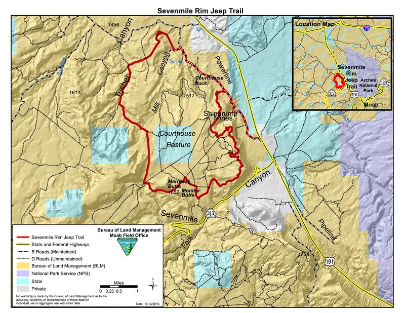
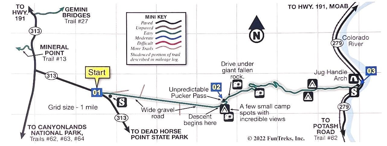
The Sevenmile Rim trail leaves Highway 191 just north of Highway 313, about 11 miles north of town. It passes the old Cotter uranium mine and switches back to reach the cliff rim above the mine and Highway 191. The intense mining activity left a maze of core-drilling roads on the mesa top, and the trail seeks the most interesting of these. At the southern end of the rim it turns west to parallel UT 313. Along the way, Uranium Arch is visited. The trail joins other roads in the vicinity of Merrimac Butte and Monitor Butte before tucking up near Big Mesa. It passes near Determination Towers before using Tusher Pass to dip into Tusher Wash and the interesting environs beyond.
The trail route is near the Moab Fault, a geological fracture that left the trademark rocks of Canyonlands standing higher than the surrounding colorful Morrison formation. Entrada Sandstone cliffs are constantly in view. The rim views include Sevenmile Canyon, the Arches National Park area, and the Book Cliffs to the north.
Approximate mileages: 51 total, 21 off highway.
Tuesday October 3rd - Trail Leader Lott
Meetup at City Market with a 8:00AM (possibly earlier!!) Mountain Time departure
Plan A: Dolores River Overlook
Plan B: Top of the World
"Top of the World" is a viewpoint on Waring Mesa. It has a spectacular view of Fisher Valley, Onion Creek, and the La Sal Mountains, but this view is only part of a variety of landscapes seen from this trail. Waring Mesa is east of Moab and south of the Dewey Bridge crossing of the Colorado River. The Entrada Sandstone is beautiful wherever it is exposed, and we travel the base of a long stretch of its cliffs near the Colorado and Dolores rivers. The Top of the World viewpoint is a cliff edge above Fisher Valley and Onion Creek with the La Sal Mountains in the southern background, and there are vistas of distant plains and the Book Cliffs to the north. Narrow Onion Creek canyon is different from anything else in the area.
Approximate mileages: 74 miles total, 10 miles off highway.
Plan up to 10 hours for both trails
City Market to Dewey Bridge: 33 miles, 45 minutes
Top of the World
Waypoint 01 to Waypoint 02:
Waypoint 02 to 04:
Return to Waypoint 02, pick up parked vehicles, continue to Dolores Overlook trail.
People not interested in Dolores River Overlook depart once everyone is accounted for.
Dolores River Overlook
Waypoint 02 to Waypoint 05:
Return to Dewey Bridge.
People check in, and go their separate ways.
Other attractions along UT-128
Approximate mileages: 74 miles total, 10 miles off highway.
Plan up to 10 hours for both trails
City Market to Dewey Bridge: 33 miles, 45 minutes
- North on US-191 N 2.9 miles
- East on UT-128 E 29.9 miles
- Just past the Dewey Bridge campground, turn right on the Top of the World trail before crossing the river
- Regroup at small parking area with primitive restroom facilities
Top of the World
- #55/p154 in guide
- Top altitude: 7048 ft ASL
- 3-5 hours
Waypoint 01 to Waypoint 02:
- Easy
- 5.3 miles
- Parking at Waypoint 02 for vehicles that won't be doing TOTW trail, also common departure point for Dolores River Overlook
Waypoint 02 to 04:
- Moderate to Extremely Difficult
- 5.4 miles
Return to Waypoint 02, pick up parked vehicles, continue to Dolores Overlook trail.
People not interested in Dolores River Overlook depart once everyone is accounted for.
Dolores River Overlook
- #56/p156 in guide
- Top altitude: 6366 ft ASL
- 5 hours (less Waypoint 01 to Waypoint 02 time)
Waypoint 02 to Waypoint 05:
- Easy
- 12.8 miles
Return to Dewey Bridge.
People check in, and go their separate ways.
Other attractions along UT-128
- Carson's Tower (short hike, sightseeing)
- Sorrel River Ranch Resort and Spa (on-site restaurant)
- Red Cliffs Lodge (on-site restaurant)
- Castle Creek Winery (near Red Cliffs Lodge)
Wednesday October 4th - Trail Leader Green
Fins and Things/Sand Flats
Meetup at 'The City Market' parking lot time 9:00AM Mountain Time
"Fins" are the Navajo Sandstone slickrock formations northeast of Moab, and the "Things" are what remains as the fins erode. The fins started as wind-blown sand dunes some 200 million years ago, they got cemented into sandstone, and they are now going full circle back to sand blowing in the wind. The trail is reached via the Sand Flats Road, and the territory it covers is the rolling country east of the Hell's Revenge trail and between Negro Bill Canyon and North Fork of Mill Creek Canyon. There are a few sudden and steep climbs on and off the slickrock that can be difficult for vehicles with long overhangs. Any tire tread will do on the slickrock, but the clearance added by tall tires is always an advantage, while an aggressive tread helps in the sand. There is a $5.00 fee for this area and it requires CASH to be deposited at the trail head.
Approximate mileages 25 total, 13 off highway.
Approximate mileages 25 total, 13 off highway.
Thursday October 5th - Trail Leader (Need Volunteer)
Start: Proper Brewing and Burger, 1393 N Hwy 191, Moab Meet 8:00am - Departure Time 8:30am
Gemini Bridges, Gold Bar Rim, Long Canyon
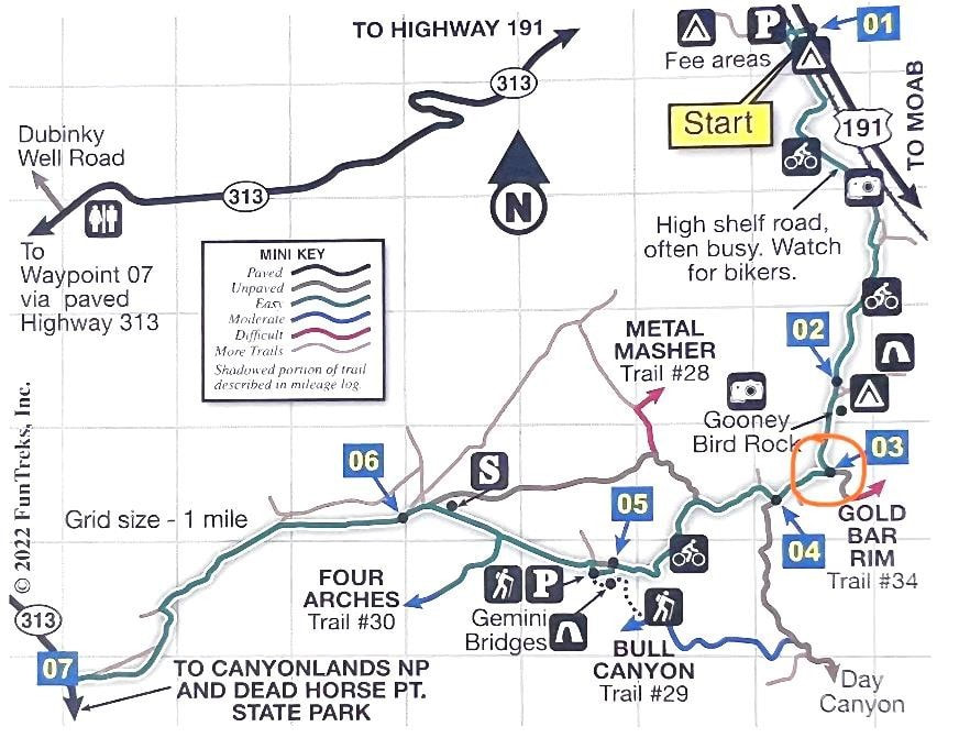
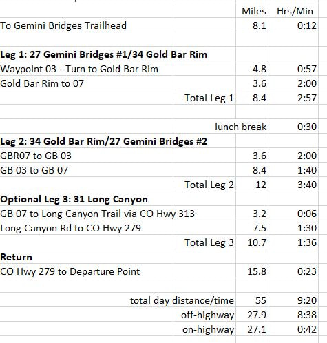
#27 Gemini Bridges (A): One of the most popular 4-wheel-drive trips in Moab. Drive slow to minimize dust, especially passing bikers. We’ll see stunning views as we cross a high winding shelf road at 2 miles. After Gooney Bird Rock, we will take a left turn to the Gold Bar Rim trail (Waypoint 3).
Rating: Easy. Minor embedded rock and possible washouts after storms.
4.8 miles/1 hour to Gold Bar Rim Trail entrance.
Start point N38 39.372 W109 40.626
High point: 6,041 ft.
Rating: Easy. Minor embedded rock and possible washouts after storms.
4.8 miles/1 hour to Gold Bar Rim Trail entrance.
Start point N38 39.372 W109 40.626
High point: 6,041 ft.
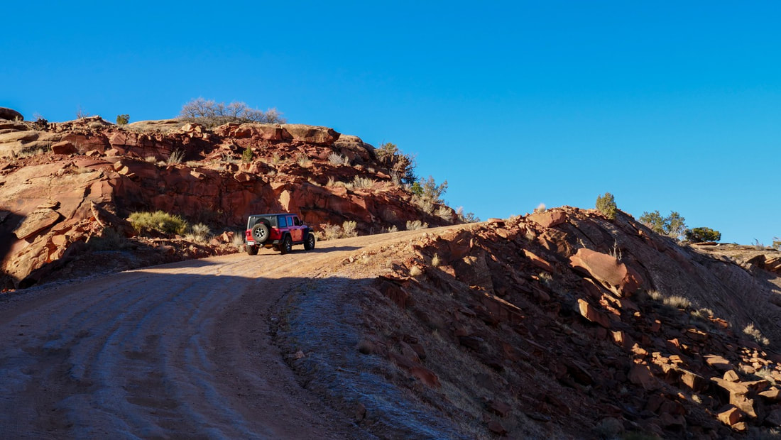
#34 Gold Bar Rim: A cliff rim that stands about 1200 feet above US 191 in Moab Canyon, the route is completely different going up than coming down and short enough to do both ways in a half day. Around every turn, there's a surprising view, and the fnal overlook at our lunch stop is dizzying.
Because the rocks behind the cliff slope downward to the southwest, the rim has a 360 degree vista. Gold Bar Canyon drains away from the rim into the Colorado River. The trail climbs to the rim in stages, first angling up to Litle Canyon, then working its way across Gold Bar Canyon to follow the slope of the Wingate Sandstone up to the rim. The Gold Bar Rim vistas take in almost all of the local country, including Moab and the Spanish Valley, the
La Sal Mountains, the Book Cliffs, and parts of the Colorado River canyon.
Rating: Difficult. Several very large ledges, including. the monumental "Waterfall." Oddly, you go down this obstacle driving up the trail and up it when you come back down. If you don't have a winch, make sure you have a friend who can throw you a strap.
Minimum vehicle modifications should include 3" lift,
33" tres, and a rear lock-er. Not for stock SUVs.
7.2 miles/4 hours (3.6/2hrs one way)
Start point: Gemini Bridges Waypoint 03.
High point: 5,420 ft. at the overlook.
#27 Gemini Bridges (B): Resume Gemini Bridges trail upon completion of Gold Bar Rim at GB Waypoint 03. There’s a short hike to the bridges at Waypoint 05…bridges are not apparent untl you get close and look down. 8.4 miles/1.75 hours
#31 Long Canyon: If tme permits, we’ll drive this canyon from top to bottom to enjoy the amazing views as we descend.
Rating: Easy
7.5 miles/1.5 hours
Start point: N38 32.693
W109 45.824 off CO 313
#31 Long Canyon: If tme permits, we’ll drive this canyon from top to bottom to enjoy the amazing views as we descend.
Rating: Easy
7.5 miles/1.5 hours
Start point: N38 32.693
W109 45.824 off CO 313
Friday October 6th - Trail Leader Dabkowski
Meetup at 'The City Market' parking lot time 9:30AM Mountain Time
Poison Spider
More information to be provided by our trail leader.
More information to be provided by our trail leader.
Saturday October 7th
Head for Home
